Geography of Mandi District
Location and Size
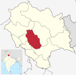
Mandi district is located in the central part of Himachal Pradesh, falling into one of the four micro-regions of the state. It lies between 31° 13′ 30″ and 32° 04′ 22″ North latitudes and 76° 36′ 08″ and 77° 23′ 26″ East longitudes.
- North and Northwest: Bordered by Kangra district
- West: Bordered by Hamirpur and Bilaspur districts
- South: Bordered by Solan and Shimla districts
- East: Bordered by Kullu district
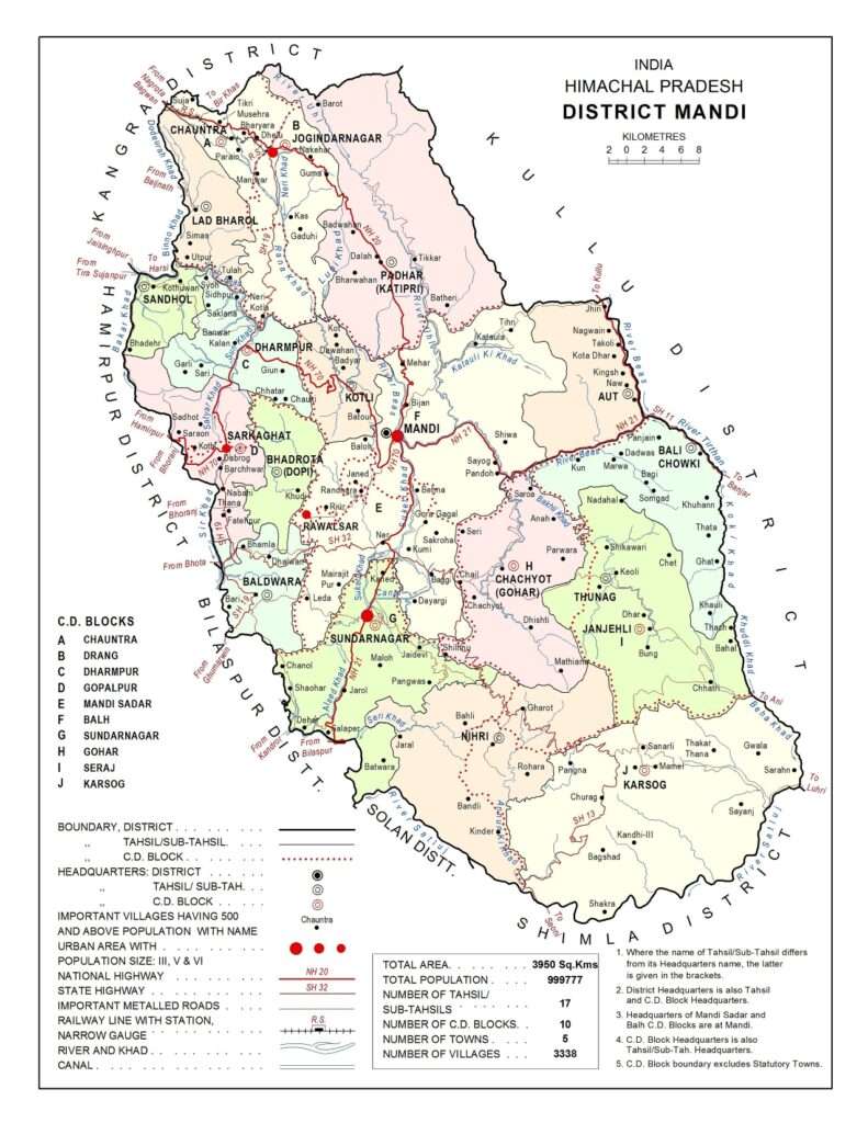
According to the Survey of India, the area of Mandi district is 3,950 square kilometers, which is 7.10% of the state’s total area of 55,673 square kilometers. It ranks seventh in terms of area among the districts.
Mandi district has a high population density, with 253 persons per square kilometer.
According to the 2011 Census:
- Population: 999,777
- It ranks second in terms of population among the districts.
- It constitutes 15.01% of the state’s total population.
- In terms of sex ratio, it ranks fourth, with 1,007 females per 1,000 males (compared to 1,013 females per 1,000 males in 2001).
Climate of Mandi District: Geography of Mand District
The district has a temperate climate due to its hilly terrain.
- Upper regions: Remain cool throughout the year.
- Padhar, Chohar, Seraj, and Sonar regions: Experience significant snowfall in winter, often extending up to 1,300 meters in elevation.
- Lower regions and Balh Valley: Can get quite hot in summer.
- Southeastern edge of the Sutlej Basin: Experiences extreme heat during certain months.
- Tata Pani and Dehar: Are among the hottest places in the district.
- Dhauladhar Micro Region: Experiences sub-temperate climate conditions and frequent snowfall in winter, with higher areas remaining cut off from other parts of the district.
- Upper regions of Beas Basin: Have a temperate climate with snowfall almost every winter, while lower regions are relatively warmer.
- Rainfall: Peaks during July and August.
- Sutlej Basin: Climate varies with altitude, being hot in lower regions and cool in higher areas, with regular snowfall in winter at Nihar, Thunag, and Karsog’s upper areas.
- Overall: Adequate and evenly distributed rainfall throughout the district.
Physical Geography and Drainage: Geography of Mand District
The district’s structure is mountainous, featuring numerous flat and rolling valleys formed by the Beas River and its tributaries.
- Balh Valley: Located in Mandi Sadar and Sundernagar tehsils, it is very wide and long.
- Chouhdar Valley: Located in Jogindernagar tehsil, it is also very wide and long, and serves as the district’s granary.
- Elevation: Ranges from 503 meters to 4,034 meters above sea level.
Mountain Ranges/Passes in Mandi District: Geography of Mand District
- Dhauladhar:
- Covers most of Suket.
- Highest peak: Nagru Nargu, approximately 4,400 meters high.
- Ghoghar Dhar: Includes mines such as Gumma and Darang.
- Sikandar Dhar:
- Named after Sikandar Lodhi.
- Divided into Kamalah Dhar and Lindy Dhar.
- Vairkot Dhar:
- Stretches from Rewalsar to Suket.
River System of Mandi District: Geography of Mand District
- Beas River:
- Entry: Enters from the eastern direction near Largi village.
- Main Tributaries: Sanj and Tirthan rivers.
- Flow Direction: Flows east to northwest.
- Exit: Exits near Sandhol to the west and enters Hamirpur district.
- Sutlej River:
- Location: Forms the southern boundary of the district, separating it from Solan and Shimla districts.
- Entry: Enters the district near Firnoo village in Chawasi area.
- Flow Direction: Flows southwest.
- Exit: Exits the district near Dehar and enters Bilaspur district.
Important Streams/Khads: Geography of Mand District
- Behna
- Ropdi
- Bagdi
- Chanod
- Alsead
These streams/khads flow into the Sutlej River from the north.
Lakes in Mandi District
- Kamarunag or Kumarwah Lake:
- Location: Chachyot tehsil at an elevation of 3,150 meters.
- Legend: Believed to have been created by Bhimasen, one of the Pandavas, in collaboration with the deity Kamrunag.
- Feature: Gold and silver offerings are made to the lake.
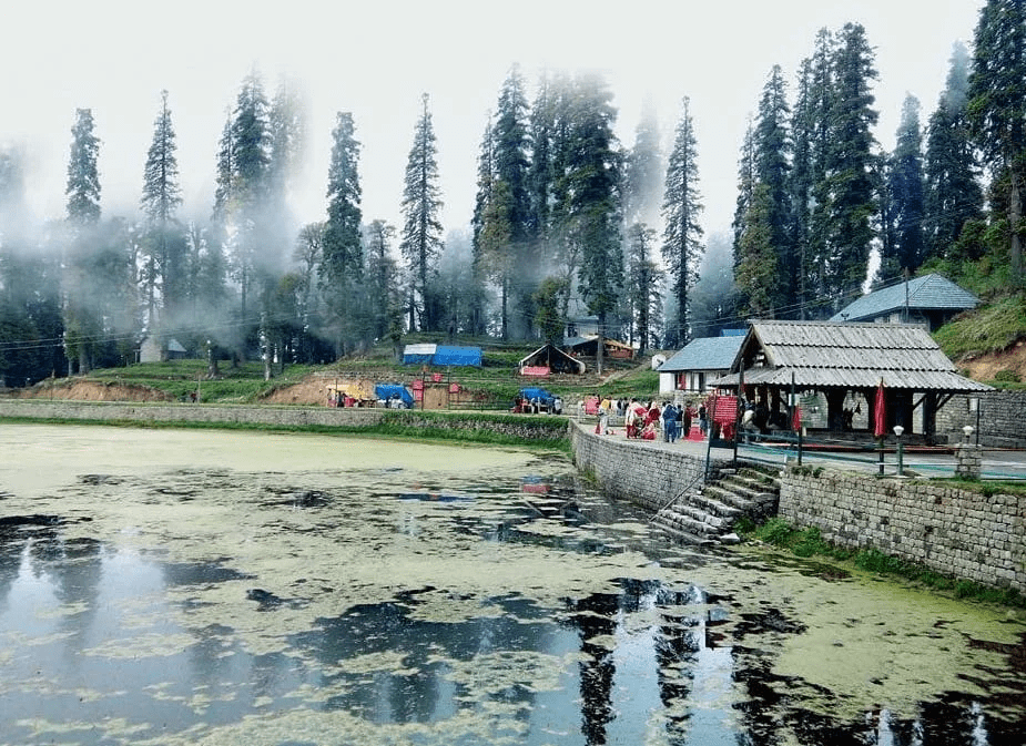
- Rewalsar Lake:

- Location: 25 km from Mandi city.
- Diameter: Three-fourths of a mile.
- Feature: Known for its floating islands, which are no longer visible. The lake is associated with Nag or serpent worship and is significant in Hindu, Buddhist, and Sikh traditions.
- Parashar Lake:
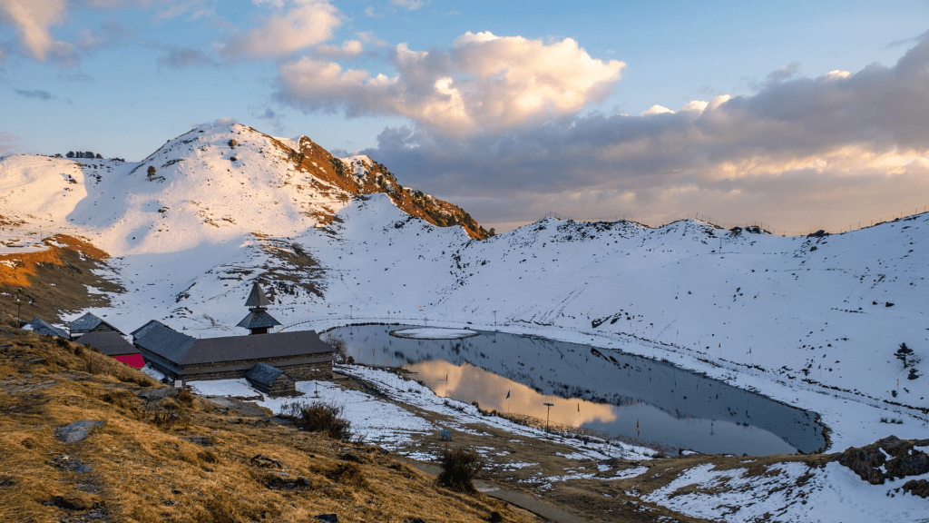
- Location: At an elevation of 2,743 meters (9,000 feet), approximately 45 km from Mandi city.
- Feature: Located in a bowl-shaped valley with a pagoda-style temple dedicated to Sage Parashar, built by King Ban Sen of Mandi.
- Machiyal Lake:
- Location: 2 km from Jogindernagar.
- Naming: Named after the deity Matsyendru Devta, an incarnation of Vishnu in fish form.
- Pandoh Lake (Artificial Lake):
- Location: 15 km from Mandi city on National Highway 21 towards Manali.
- Feature: Created by diverting Beas River water towards the Sutlej River for the construction of the Pandoh Dam.
Geographical Sub-Divisions of Mandi District: Geography of Mand District
Based on geographic location, climate, soil, natural vegetation, and geology, Mandi district is divided into four sub-micro-regions:
- Dhauladhar:
- Location: Extends through the northern and northeastern parts of Mandi, stretching from northwest to southeast up to Dhauladhar in Kangra district.
- Area: Includes northeastern parts of Jogindernagar tehsil, most of Padhar tehsil, northeastern parts of Mandi tehsil, and northwestern parts of Aut sub-tehsil.
- Geography: Rugged and mountainous, with snow-capped peaks above 4,000 meters.
- Main River: Uhl River, with tributaries like Jakhwan, Panchwad, Bubbu Nall, Sang Nall, Baroh Nall, and Bathri Khadd.
- Beas Basin:
- Location: Spans the central part of the district from northwest to southeast.
- Area: Includes southwestern corner of Padhar tehsil, northwestern, western, and southern parts of Jogindernagar tehsil, Ladd-Bharol, Sandhol, Bali Chouki sub-tehsil, entire Chachyot tehsil, Dharmpur, Kotli, Aut sub-tehsil, and most of Mandi tehsil.
- Borders: Surrounded by Kullu district to the east, Dhauladhar to the north and northeast, Kangra and Hamirpur districts to the northwest, Mandi Lesser Himalayas to the west, and Sutlej Basin to the south.
- Geography: Predominantly hilly with numerous streams such as Sikandar Dhar, Margholi Dhar, Bhubri Dhar, Rajotu Dhar, Chharyand Dhar, and Shikari Devi Dhar.
- Main River: Beas River.
- Sutlej Basin:
- Location: Covers the southern part of the district.
- Area: Includes all of Sundernagar tehsil (excluding the northern part), southern Thunag tehsil, entire Karsog tehsil, and a small northern part of Nihar sub-tehsil.
- Borders: Surrounded by Beas Basin and Mandi Lesser Himalayas to the north, Bilaspur district to the west, and Kullu district to the east.
- Geography: Rugged and hilly with streams ranging from 2,160 meters to 3,124 meters in elevation.
- Main River: Sutlej River.
- Mandi Lesser Himalayas:
- Location: Spans the western part of the district.
- Area: Includes entire Baldwara sub-tehsil, Bhadrata sub-tehsil, Sarkaghat tehsil, southern part of Dharmpur sub-tehsil, southwestern part of Kotli sub-tehsil, western part of Mandi tehsil, and a small central part of Sundernagar tehsil.
- Borders: Adjoins Beas Basin to the north and east, Sutlej Basin to the south, and Bilaspur and Hamirpur districts to the west.
- Geography: Rugged and hilly with elevations ranging from 682 meters to 2,051 meters above sea level.
- Main Rivers: Baker, Sar, Son, and Ratti Khadd.
FAQs about Mandi District
1. Where is Mandi District located?
Mandi District is situated in the central part of Himachal Pradesh, India. It is bordered by the Kullu District to the east, the Kangra District to the north and northwest, the Hamirpur and Bilaspur Districts to the west, and the Solan and Shimla Districts to the south.
2. What is the total area of Mandi District?
The total area of Mandi District is 3,950 square kilometers, which constitutes 7.10% of the total area of Himachal Pradesh.
3. What is the population of Mandi District according to the 2011 Census?
According to the 2011 Census, Mandi District has a population of 999,777. It is the second most populous district in Himachal Pradesh.
4. What are the major rivers in Mandi District?
The major rivers in Mandi District are the Beas River and the Sutlej River. The Beas River flows from the east and north-east of the district, while the Sutlej River forms the southern boundary of the district.
5. What is the climate like in Mandi District?
Mandi District has a temperate climate due to its hilly terrain. The upper regions experience cool weather throughout the year with substantial snowfall in winter, while the lower regions, including the Balh Valley, can be quite warm in summer. The Sutlej Basin experiences extreme heat in summer.
6. What are some notable valleys in Mandi District?
Notable valleys in Mandi District include the Balh Valley and the Chontadra Valley. The Balh Valley is wide and long, situated in the Mandi Sadar and Sundernagar tehsils, and is known for its agricultural significance.
7. What are the major peaks and mountain ranges in Mandi District?
Mandi District features several prominent mountain ranges and peaks, including the Dhauladhar Range with peaks like Nagarunargu and the SIkandar Dhar Range. The district also contains parts of the Mandi Small Himalayas.
8. Which lakes can be found in Mandi District?
Mandi District is home to several lakes, including:
- Kamrunag Lake: Located in the Chachyot tehsil at an elevation of 3,150 meters.
- Rewalsar Lake: Situated 25 kilometers from Mandi city, known for its floating islands.
- Parashar Lake: Located at an elevation of 2,743 meters, approximately 45 kilometers from Mandi city.
- Machiyal Lake: Found 2 kilometers from Jogindernagar, named after the deity Machhendru.
- Pandoh Lake: An artificial lake created by the Pandoh Dam on the Beas River.
9. What are the sub-micro regions of Mandi District?
Mandi District is divided into four sub-micro regions based on geographical features:
- Dhauladhar: The northern and northeastern part, with rugged terrain and high peaks.
- Beas Basin: Central region of the district, featuring several valleys and the Beas River.
- Sutlej Basin: Southern part of the district, characterized by hilly terrain and the Sutlej River.
- Mandi Small Himalayas: The western part of the district, featuring varied elevations and mountainous terrain.
10. What are the main economic activities in Mandi District?
The main economic activities in Mandi District include agriculture, horticulture, and tourism. The region is known for its production of fruits like apples, pears, and peaches, and is also a popular destination for tourists due to its natural beauty and cultural heritage.
These FAQs provide an overview of key aspects of Mandi District, including its location, climate, geography, and notable features.
MCQs about Mandi District
- Where is Mandi District located?
- A) Northern Himachal Pradesh
- B) Central Himachal Pradesh
- C) Southern Himachal Pradesh
- D) Western Himachal Pradesh
- What is the total area of Mandi District?
- A) 2,950 square kilometers
- B) 3,450 square kilometers
- C) 3,950 square kilometers
- D) 4,450 square kilometers
- Which river flows through Mandi District and is a major watercourse?
- A) Yamuna River
- B) Ganges River
- C) Beas River
- D) Ravi River
- Which district borders Mandi to the south?
- A) Kullu District
- B) Kangra District
- C) Shimla District
- D) Solan District
- What is the population of Mandi District according to the 2011 Census?
- A) 899,777
- B) 999,777
- C) 1,099,777
- D) 1,199,777
- Which peak is part of the Dhauladhar Range in Mandi District?
- A) Mount Everest
- B) Nagarunargu
- C) K2
- D) Kanchenjunga
- What is the elevation of Parashar Lake?
- A) 2,243 meters
- B) 2,543 meters
- C) 2,743 meters
- D) 2,943 meters
- Which valley in Mandi District is known as an important agricultural area?
- A) Chamba Valley
- B) Kullu Valley
- C) Balh Valley
- D) Lahaul Valley
- Which river forms the southern boundary of Mandi District?
- A) Chenab River
- B) Jhelum River
- C) Sutlej River
- D) Indus River
- Which of the following lakes is an artificial lake in Mandi District?
- A) Kamrunag Lake
- B) Rewalsar Lake
- C) Parashar Lake
- D) Pandoh Lake
- What is the elevation range of Mandi District?
- A) 500 meters to 3,000 meters
- B) 503 meters to 4,034 meters
- C) 700 meters to 3,500 meters
- D) 800 meters to 3,800 meters
- Which sub-micro region of Mandi District is known for its high peaks and rugged terrain?
- A) Beas Basin
- B) Sutlej Basin
- C) Dhauladhar
- D) Mandi Small Himalayas
- Which of the following valleys is located in Mandi District?
- A) Kangra Valley
- B) Pabbar Valley
- C) Chontadra Valley
- D) Tirthan Valley
- What is the primary economic activity in Mandi District?
- A) Mining
- B) Agriculture and Horticulture
- C) Manufacturing
- D) IT and Software Services
- Which river’s tributaries include Uhl, Ranna Khad, and Luni Khad?
- A) Sutlej River
- B) Beas River
- C) Chenab River
- D) Jhelum River
- Which lake in Mandi District is famous for its floating islands?
- A) Kamrunag Lake
- B) Rewalsar Lake
- C) Machiyal Lake
- D) Pandoh Lake
- What is the typical climate in the upper regions of Mandi District?
- A) Tropical
- B) Arid
- C) Temperate with cold winters
- D) Subtropical
- Which district is located to the east of Mandi District?
- A) Bilaspur District
- B) Kullu District
- C) Hamirpur District
- D) Solan District
- Which of the following is not a major river in Mandi District?
- A) Beas River
- B) Sutlej River
- C) Yamuna River
- D) Chenab River
- What is the key feature of the Dhauladhar Range in Mandi District?
- A) Low elevation
- B) Dense forests
- C) Snow-capped peaks over 4,000 meters
- D) Desert terrain
Answer Key
- B) Central Himachal Pradesh
- C) 3,950 square kilometers
- C) Beas River
- D) Solan District
- B) 999,777
- B) Nagarunargu
- C) 2,743 meters
- C) Balh Valley
- C) Sutlej River
- D) Pandoh Lake
- B) 503 meters to 4,034 meters
- C) Dhauladhar
- C) Chontadra Valley
- B) Agriculture and Horticulture
- B) Beas River
- B) Rewalsar Lake
- C) Temperate with cold winters
- B) Kullu District
- C) Yamuna River
- C) Snow-capped peaks over 4,000 meters
Also Read: Census Of Mandi District
मंडी जिले की भौगोलिक स्थिति
स्थान और सीमाएँ
- स्थान: मंडी जिला हिमाचल प्रदेश के मध्य भाग में स्थित है। इसकी भौगोलिक स्थिति 31°13′30″N से 32°04′22″N उत्तरी अक्षांश और 76°36′08″E से 77°23′26″E पूर्वी देशांतर के बीच है।
- सीमाएँ:
- उत्तर और उत्तर-पश्चिम: कांगड़ा जिला
- पश्चिम: हमीरपुर और बिलासपुर जिले
- दक्षिण: सोलन और शिमला जिले
- पूर्व: कुल्लू जिला
क्षेत्रफल और जनसंख्या
- कुल क्षेत्रफल: 3,950 वर्ग किलोमीटर, जो हिमाचल प्रदेश के कुल क्षेत्रफल का लगभग 7.10% है।
- जनसंख्या घनत्व: प्रति वर्ग किलोमीटर लगभग 253 व्यक्ति।
- 2011 की जनगणना के अनुसार:
- कुल जनसंख्या: 9,99,777
- जनसंख्या रैंक: हिमाचल प्रदेश के जिलों में जनसंख्या के मामले में दूसरा स्थान
भू-आकृति और ऊँचाई
- सामान्य भू-आकृति: जिले की भौगोलिक संरचना पहाड़ी है, जिसमें कई घाटियाँ और ऊबड़-खाबड़ इलाके शामिल हैं।
- ऊँचाई: समुद्र स्तर से 503 मीटर से लेकर 4,034 मीटर तक की ऊँचाई वाली विविध इलाके।
जलवायु
- सामान्य जलवायु: मंडी जिला एक पहाड़ी क्षेत्र है, जहाँ की जलवायु समशीतोष्ण है।
- ऊपरी क्षेत्र: सर्दियों में ठंडी और बर्फबारी होती है।
- निचले क्षेत्र: गर्मियों में अपेक्षाकृत गर्म होते हैं।
- वर्षा: अधिकांश वर्षा मानसून के महीनों में होती है, और जुलाई-अगस्त में अधिक वर्षा होती है।
भौगोलिक उप-क्षेत्र
- धौलाधार:
- स्थिति: उत्तर और उत्तर-पूर्वी मंडी तक फैली हुई।
- मुख्य नदी: उहल नदी
- ब्यास बेसिन:
- स्थिति: जिले के मध्य भाग में फैला हुआ।
- मुख्य नदी: ब्यास नदी
- सतलुज बेसिन:
- स्थिति: जिले के दक्षिणी भाग में फैला हुआ।
- मुख्य नदी: सतलुज नदी
- मंडी लघु हिमालय:
- स्थिति: पश्चिमी भाग में फैला हुआ।
- मुख्य नदियाँ: बेकर, सर, सोन, और रत्ती खड्ड
नदियाँ और झीलें
- मुख्य नदियाँ:
- ब्यास नदी: जिले में लारगी गांव के पास प्रवेश करती है और संधोल के निकट पश्चिम में बाहर निकलती है।
- सतलुज नदी: चवासीगढ़ क्षेत्र में प्रवेश करती है और डेहर के पास बाहर निकलती है।
- झीलें:
- कमरुनाग झील: 3,150 मीटर की ऊँचाई पर स्थित।
- रिवालसर झील: मंडी शहर से 25 किमी दूर।
- पराशर झील: 2,743 मीटर की ऊँचाई पर स्थित।
- मचियाल झील: जोगिंदरनगर से 2 किमी दूर।
- पंडोह झील: मंडी शहर से 15 किमी दूर, कृत्रिम झील।
भौगोलिक उप-क्षेत्रों का विवरण
- धौलाधार:
- भूआकृतिक: ऊबड़-खाबड़ और पहाड़ी
- ब्यास बेसिन:
- भूआकृतिक: कई धाराओं और पहाड़ी क्षेत्रों के साथ
- सतलुज बेसिन:
- भूआकृतिक: ऊबड़-खाबड़ और पहाड़ी
- मंडी लघु हिमालय:
- भूआकृतिक: ऊबड़-खाबड़ और पहाड़ी, समुद्र स्तर से ऊँचाई 682 मीटर से 2,051 मीटर